


For the first time in three decades, Brisbane is battening down for the arrival of a tropical cyclone. Follow us here for breaking news and advice throughout the day.
For the first time in three decades, Brisbane is battening down for the arrival of a tropical cyclone. Follow us here for breaking news and advice throughout the day.
If you are just joining us today, here is what you need to know:
- Millions of people are finalising preparations as Cyclone Alfred barrels towards the Australian coast.
- Cyclone Alfred is expected to make landfall as a category 2 system in Brisbane – possibly just south of the CBD – in the early hours of Friday morning, but possibly earlier.
- The danger stretches far further afield and wild weather is tipped to start up from Wednesday, with the warning zone from Double Island Point in Queensland to Yamba in northern NSW, south of Byron Bay.
- Alfred is set to bring flash flooding, heavy rain, destructive winds and storm surges at its height, with south-east Queensland facing its first direct cyclone impact in 50 years.
“Several hundreds of millimetres of rain is possible within six hours, which could lead to life-threatening flash flooding,” the bureau’s senior meteorologist Christie Johnson said.
Brisbane, Gold Coast and Queensland hinterland are most at risk of copping the brunt of the strong winds while residents in NSW’s Northern Rivers have been told to stay inside and secure anything that could blow away.
More than 4 million people are in the firing line. About 20,000 homes in Brisbane, and more across south-east Queensland and northern NSW, are at risk of flooding.
The Bureau of Meteorology is also warning that the system could reach a low-end category 3 storm before making landfall, although it is a low possibility.
Our team has created some fantastic graphics to explain the cyclone as it continues to barrel towards south-east Queensland and northern New South Wales.
Ever wondered how a cyclone is actually made?
This is the latest map, showing where Cyclone Alfred is expected to track over the next couple of days.
And a map showing the latest weather warning areas in Queensland, stretching across multiple council areas.
Brisbane City Council has released a map showing the areas most at risk, including Windsor, Ashgrove, Morningside and Rocklea, but we’re hearing some people are having trouble working out how to use it.
The map can be accessed on Brisbane City Council’s emergency dashboard here, and when it opens up, it shows a zoomed-out view of the city coloured orange.

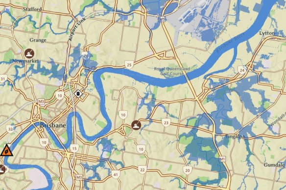
While the tool can be used to show emergency incidents, traffic crashes, power outages and evacuation centres later during the cyclone, it can also be used to show flood risk now.
If you zoom in either using the “plus” and “minus” buttons, a mouse scroll wheel on a desktop computer, or by using your fingers to zoom on a phone, you will be able to see patches of blue indicating potential flood areas across the city.
Memories of the last cyclone to hit southeast Queensland more than 50 years ago have spurred Russell Field to action.
The Liberal National Party MP arrived at a sandbagging site in Capalaba today hoping to get enough to safeguard his home ahead of Cyclone Alfred’s arrival.

He ended up staying to help others as they battled to shovel sand, including the elderly and a local with a colostomy bag.
“It’s better exercise than walking,” Field said.
A council worker said it had been “chaos” all morning as they ran out of bags with traffic jams in the car park.
It will mark the first time a cyclone has hit the southeast coast since Cyclone Zoe struck in 1974, which Field remembers.
“Back in those days we thought we’d go look at the flooding so we got in our cars and drove out, but that was an eye-opener,” he said.
“We can’t control what’s going to happen but always prepare for it.
“There will be a lot of people who say in hindsight they didn’t have to do what they did, but it’s better to do it just in case to avoid heartache later down the track.”
AAP
All Qantas and Jetstar flights to and from Ballina in northern NSW have been cancelled ahead of worsening weather brought by Tropical Cyclone Alfred.
A Qantas spokesperson said both airlines had cancelled flights to and from the town today. Several flights to Coffs Harbour have also been cancelled.

A Virgin flight scheduled to depart Sydney Airport for Ballina at 10.50am today was also cancelled.
A Virgin Australia spokesperson said customers travelling to and from northern NSW should monitor flight information on the airline’s website.
Sydney Airport is “monitoring the situation closely and are supporting airlines with their contingency planning”, a spokesperson said.
Airservices Australia said it had put “staff contingency plans and emergency operational assets in place, including backup power supplies, to help us provide necessary support to Australia’s aviation sector throughout the coming days”.
“Decisions on whether to cancel flights are a matter for airlines, and passengers with travel plans over coming days are advised to check the status of their flight with their airline,” it said.
As panic buying impacts supply at grocery stores in the path of Cyclone Alfred, Emergency Management Minister Jenny McAllister said she has spoken with the chief executives of both Coles and Woolworths in the last 24 hours to manage the situation.
“They’re working really closely with state governments to make sure that they can have the supplies that are necessary,” she said, noting that right now the issue is the volume of demand on supermarkets.


“Local people are heeding the warnings and starting to prepare their homes in the event that they might have to stay home and manage for themselves for a few days, creating additional volume.”
Prime Minister Anthony Albanese said the Commonwealth, NSW and Queensland governments would work together in the face of Cyclone Alfred.
“There is no Tweed border here. This is not recognised by the cyclone and it certainly should not be recognised by government responses,” he said.
“And to assure people as well, there have been NSW people present in the briefings this morning, the same thing has happened with Queenslanders being present at NSW briefings, and the national emergency agency headquarters in Canberra will ensure that there is that coordination as well.”
Looking back to the prime minister’s press conference in Brisbane earlier today, Anthony Albanese confirmed the Australian Defence Force is now engaged to provide support for the incoming Cyclone Alfred.
Albanese said both Queensland and NSW have to be ready for the intensity of the weather.
“Prepare, take this seriously, this is a rare event,” he said.
“I said yesterday that we would put the ADF on standby and we have now received a formal request and the ADF is now engaged as of right now.”
Albanese listed the national supports in place, noting 125,000 additional sandbags have been delivered, on top of 80,000 that arrived yesterday, as well as the pre-positioning of heavy-lift helicopters from the national aerial firefighting fleet.
“A Sikorsky S-61 has been deployed to Coffs Harbour. The UH-60 Black Hawk will be pre-positioned in Bundaberg,” he said.
Cars have been filmed dragging away parked cars on the Gold Coast, as huge swells batter the region.
Vehicles parked in the car park of the Currumbin Beach Vikings Surf Life Saving Club were swamped this morning.
Footage on Instagram and TikTok shows one man managing to get into his car after it is picked up and moved by the powerful surf.
If you are searching for “Cyclone Alfred” on Facebook, you might be confused.
Facebook users are being referred to a Climate Change Centre when they search for “Cyclone Alfred”. Those who search “Alfred” appear to receive more information.

It comes as tech giants complain about the federal government’s allegedly secretive planning for its under-16 social media ban following the threat made by US President Donald Trump last month to penalise countries targeting American digital platforms.
Meta, which owns Facebook and Instagram, has accused Federal Communications Minister Michelle Rowland of taking a stealth approach to working out the details of how the age restriction would work.
You can read more about that, here.
Flood releases from Queensland’s Somerset and Wivenhoe dams are likely in the next two days.
In its latest alert, Seqwater says its flood engineers are monitoring the weather and dam conditions.

“These releases will consider downstream flows in accordance with the manual of operational procedures for flood mitigation for Somerset Dam and Wivenhoe Dam,” the alert reads.
“The Wivenhoe Dam flood storage compartment is at 100 per cent of its capacity.“
Brisbane is expected to get up to 130 millimetres of rain on Thursday, up to 150 millimetres on Friday, and up to 120 millimetres on Saturday.