

Sydney’s punishing heatwave has given way to rain and storms as the predicted cool change has rolled into the city. Follow live updates.
Sydney’s punishing heatwave has given way to rain and storms as the predicted cool change has rolled into the city. Follow live updates.
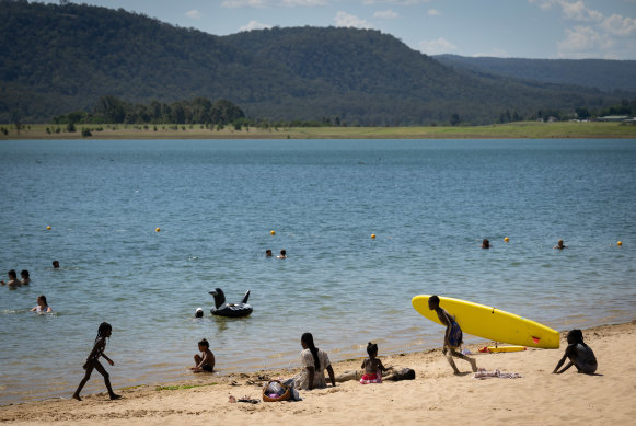
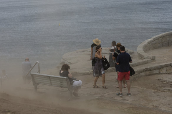
From eastern suburbs beaches, to swimming holes in the Blue Mountains, many have spent the day escaping the day’s heat in Sydney’s waterways, before late afternoon saw the storms roll in.
Here are some highlights from Herald photographers:
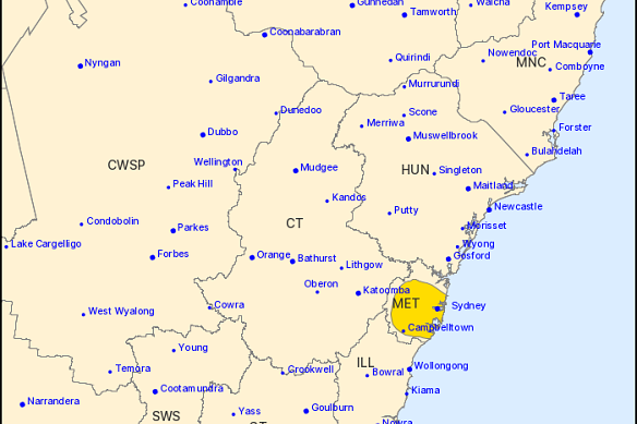
The NSW SES has received more than 150 callouts since severe thunderstorms hit Sydney on Tuesday afternoon.
By just after 5pm, the service had received 174 callouts, including 129 for fallen trees and about 20 related to powerlines and electrical issues.
The calls have come from across Sydney, with Parramatta, Blacktown and Campbelltown among the worst affected.
The SES on Tuesday afternoon issued a warning for people in Greater Sydney, Penrith, Parramatta, Gosford and Woy Woy to monitor conditions for forecast heavy rainfall, damaging winds and large hailstones.
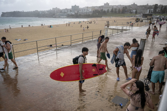
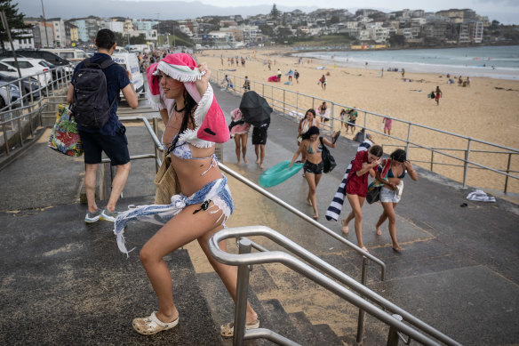
Beachgoers flocking to the world-famous Bondi Beach to enjoy the sunshine ran for cover as the first of the heavy rainfall expected to soak Sydney tonight reached the city.
With towels slung over their heads, many frantically collected their belongings and made a quick exit.
Rain has swept across Sydney as temperatures plummet after the city sweated through the hottest day of 2025 so far.
The first of the heavy rainfall seems to have passed through, but severe thunderstorm warnings remain in place after the initial deluge, with the Bureau of Meteorology advising that parts of Sydney may experience flash flooding.
The Herald’s chief photographer Nick Moir captured a time-lapse showing the moment the storms hit Sydney.
The images, taken from Ingleside on the northern beaches, show Sydney’s skyscrapers disappearing behind heavy rainfall as storm clouds roll by.
From eastern suburbs beaches, to swimming holes in the Blue Mountains, many have spent the day escaping the day’s heat in Sydney’s waterways, before late afternoon saw the storms roll in.
Here are some highlights from Herald photographers:
A severe thunderstorm warning has been issued for parts of Sydney as rain begins to fall across the city.
The Bureau of Meteorology said damaging winds, large hailstones and heavy rainfall that may lead to flash flooding were forecast.
Sydney city, Penrith, Parramatta and Campbelltown were expected to be affected.
The thunderstorm was expected to hit waters off Bondi Beach by 4.20pm and waters off Manly Beach half an hour later, the BOM said.
The thunderstorms, moving east to northeast, were expected to affect the Sydney Harbour Bridge at about 5pm.
The storms have brought with them a cool change, with the temperature at Sydney Airport dropping from a high of 42.5 degrees at 1.34pm to 24 degrees by 3.50pm.
People are advised to move their cars under cover or away from trees, secure or put away loose items around their backyards and balconies, keep clear of creeks and storm drains, keep least eight metres from fallen powerlines and stay indoors and away from windows.
Temperatures in parts of south-west Sydney have dropped 10 degrees in less than 20 minutes as a cool change hits the city, bringing with it the day’s first rainfall.
At Holsworthy, the temperature dropped from a high of 41.6 degrees to 31.4 degrees in just 16 minutes. By 3.30pm, the temperature had dropped to 29.7 degrees.
Temperatures in other parts of Sydney’s south-west, including Campbelltown and Canterbury, dropped almost 10 degrees in about half an hour after recording highs of over 40 degrees.
Some rain began to fall in Sydney’s CBD just after 3.30pm.
The forecast cool change expected to bring widespread relief to sweaty Sydneysiders has hit south of the city, with temperatures dropping almost 20 degrees in two and a half hours.
The temperature in Nowra, which reached a high of 39 degrees at 12.20pm, had dropped to 22.6 degrees by 3pm, according to the Bureau of Meteorology.
In Kiama, the 3pm temperature of 23.1 degrees was 16.5 degrees cooler than the recorded high of 39.6 degrees recorded at 12.22pm as wind gusts reached up to 85km/h just before 2.30pm.
At Bellambi, north of Wollongong, the temperature dropped from 36.9 degrees at 11.20am to 23.4 degrees by just after 3pm, with gusts of up to 76km/h recorded.
While Sydney expectantly awaits the much-needed relief of the afternoon’s forecast cool change, we want to know how you’re beating the heat.
Whether you’re at the beach or in the backyard, send us your pictures and let us know how you’re staying cool.
Temperatures in Sydney’s west have climbed to over 42 degrees.
By 2.30pm, the temperature at Penrith had reached 42.1 degrees, according to the Bureau of Meteorology, while Bankstown hit a high of 41.8 degrees.
At Sydney Airport, a high of 42.5 degrees was recorded at 1.34pm, while the temperature reached 41.1 degrees just before 2.30pm.
Badgerys Creek’s temperature soared to 42.6 degrees, the hottest recorded temperature of the day so far, as Richmond, Horsley Park, Holsworthy, Canterbury, Campbelltown and Camden all recorded over 40 degrees.
In the Illawarra, temperatures in Nowra and Kiama reached 39 degrees while much of the South Coast escaped the harshest of the heat.
As Sydneysiders try to cool off during the hottest day of the year so far, a reprieve should be on the way in the form of the famous southerly buster.
But how exactly does it work?
Dubbed “the genie of Sydney”, the gust can cause scorching temperatures to plummet in a matter of minutes, while wreaking havoc for firefighters by stoking bushfires.
For a southerly buster to be declared, gusts blowing north must exceed 54km/h, or 15 metres per second, and the temperature must drop by at least 5 degrees over three hours, according to the Bureau of Meteorology.
Read science reporter Angus Dalton’s story on how the southerly buster has changed in the past 25 years here.
Discover more from World Byte News
Subscribe to get the latest posts sent to your email.