





Cyclone Alfred has slowed considerably as it moves towards the coast, and could now make landfall as late as Friday evening.
Cyclone Alfred has slowed considerably as it moves towards the coast, and could now make landfall as late as Friday evening.
- Updated
- National
- Queensland
- Extreme weather
By Cloe Read
Updated March 5, 2025 — 7.38pmfirst published at 7.18pm
Millions of people are hunkering in their homes, while others rush to evacuation centres, as Cyclone Alfred heads towards Queensland – just not as fast as it was earlier.
Cyclone Alfred has slowed considerably as it moves towards the coast, and could make landfall much later than previously predicted.
The Bureau of Meteorology issued its latest cyclone bulletin about 8pm on Wednesday, with a new tracking map showing Alfred making landfall – possibly directly over Brisbane – at 7pm on Friday.
Alfred had earlier been forecast to make landfall in the early hours of Friday, but by Wednesday night, it had slowed from 11km/h to 7km/h and was 365 kilometres east of Brisbane.
The cyclone’s exact landing point was yet to be determined, but the weather bureau’s latest bulletin had it crossing between Maroochydore and Coolangatta.
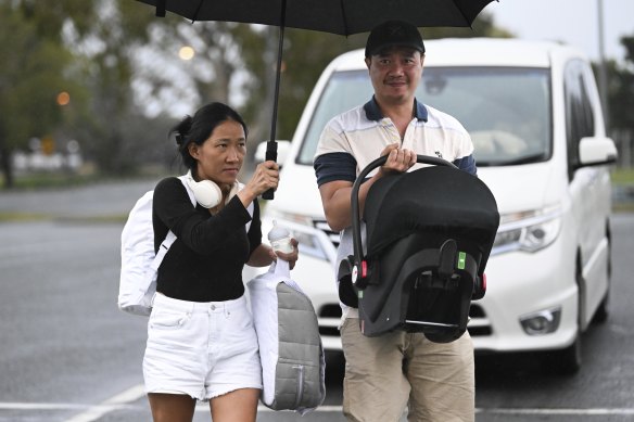
The cyclone’s “gust radius” was already affecting the Gold Coast on Wednesday night, prompting residents, including a couple with their young baby, to seek shelter at an evacuation centre at Runaway Bay.
The bureau has warned there is a slight chance the cyclone could intensify to a category 3 storm before it makes landfall.
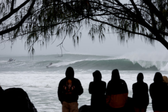
The first cyclone to hit Queensland’s south-east in more than 50 years is set to bring heavy rain, flash flooding, storm surges and destructive wind gusts up to 155km/h.
Advertisement
Alfred could dump 400 millimetres of rain – almost half a year’s worth – over Brisbane in just 24 hours.
Four million people are in the firing line and about 20,000 Brisbane properties are at risk of flooding.
Schools will be closed on Thursday and Friday, public transport has come to a standstill and the federal government has Black Hawk helicopters on standby.
Loading
Evacuations at aged care facilities in low-lying areas began on Wednesday, while residents in Brisbane’s flood-prone suburbs were packing their bags to stay with friends and family.
“We don’t go and forcibly drag people out of their homes … police will go around and say to people ‘you need to leave your home now’,” Acting Police Commissioner Shane Chelepy said.
“Those people who don’t leave their homes … that puts you, your family and us in a really dangerous situation.”
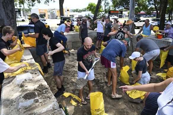
Emergency alerts were issued across the south-east on Wednesday afternoon amid “chaos” at sandbagging sites as many people made last-minute preparations.
The federal government promised to deliver 250,000 extra sandbags on Wednesday to keep up with demand after many queued for hours.
“This is a rare event to have a tropical cyclone in an area that is not classified as part of the tropics,” Prime Minister Anthony Albanese said.
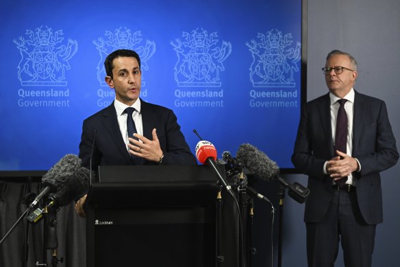
Earlier in the day, Premier David Crisafulli said the cyclone was likely to cross in the middle of the night, and he urged people to make as many preparations as possible before it was too late.
“It’s happening. Exactly where, we’ll continue to tighten, exactly how strong and exactly when, they’re the variables, but that window is closing,” he said.
“The one thing that is not negotiable, the one that’s been consistent for a long time, is that it is going to cross.”
A refuge centre will open at Brisbane’s RNA Showgrounds in Bowen Hills for people unable to stay with family or friends, but Lord Mayor Adrian Schrinner said the safest place for the majority of residents would be at home.
Brisbane’s western suburbs started experiencing power outages on Wednesday, with strong winds bringing trees down over powerlines in Bardon, Mt Coot-tha, Toowong, and Brookfield.
‘This is a rare event, an extremely rare event. It’s been half a century since a system of this size crossed this far south.’
Premier David Crisafulli
Flood releases are likely at Queensland’s Somerset and Wivenhoe dams in the next two days, with several ungated dams already spilling.
Qantas cancelled a number of flights on Wednesday, Carnival Luminosa’s three-day cruise was called off, and Greyhound bus services from Brisbane were axed.

The cyclone’s impact is also set to be felt interstate, with the warning zone spanning Double Island Point, just south of K’gari, to Grafton in NSW. More than 100 schools have closed in the Northern Rivers region, with locals urged not to panic-buy.
Uncertainty remained around flights in and out of Brisbane, with some airlines cancelling services into Thursday. Gold Coast and Ballina airports closed, but Brisbane Airport remained open.
“Brisbane Airport will continue to operate its terminals as long as airlines schedule flights in and out, for emergency and aero medical services, for defence operations, and while it is safe to do so,” the airport authority said on Wednesday afternoon.
Acting Mayor Donna Gates said Gold Coast Airport management was hopeful it would reopen on Saturday, depending on the weather.
Start the day with a summary of the most important and interesting stories, analysis and insights. Sign up for our Morning Edition newsletter.
Loading
Discover more from World Byte News
Subscribe to get the latest posts sent to your email.
