





With the destructive cyclone now on track to make landfall, the deputy premier speaks directly to SEQ supermarkets to keep supplies in stores.
With the destructive cyclone now on track to make landfall, the deputy premier speaks directly to SEQ supermarkets to keep supplies in stores.
By Cameron Atfield
Updated March 4, 2025 — 11.40amfirst published at 5.00am
Up to 700 millimetres of rain is expected in areas south of Cyclone Alfred’s coastal crossing, which latest modelling suggests will be near the Redcliffe peninsula.
“We’re likely to see the strongest impacts close to those areas or to the south, as the heaviest rain and strongest winds generally wrap around that southern flank of a tropical cyclone,” Bureau of Meteorology senior meteorologist Miriam Bradbury said.
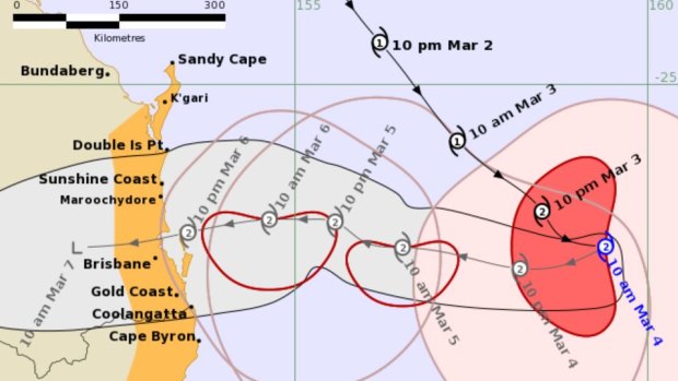
As of 11am on Tuesday, the category 2 cyclone was about 630 kilometres east of Brisbane, moving south-east at 13km/h.
The weather bureau expected Alfred, which has sustained 95km/h winds near its centre and gusts of up to 130km/h, to turn west towards the coast later on Tuesday.
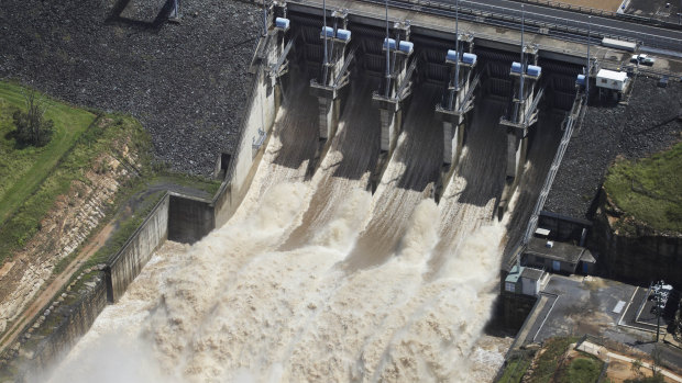
South-east Queensland dam operators were on alert as the region’s flood mitigation system faced its greatest test since the deadly 2011 floods.
Bradbury said flood watches were in place for south-east Queensland and north-east NSW before expected heavy rainfall.
“We may see isolated falls of 600 or 700 millimetres through some of these areas, although that will depend on exactly where the cyclone crosses,” she said.
Bradbury said there was a likelihood of “dangerous riverine flooding” across the weekend and into early next week, “although we may see it occurring as early as Wednesday night”.
Advertisement
As of Tuesday morning, Wivenhoe was at 86.8 per cent capacity, with 100 per cent of its flood storage volume of 2.2 million megalitres still available. Somerset was at 80 per cent, with 99.8 per cent of its 705,000 megalitres of flood storage available.
Premier David Crisafulli said dam operators had to be upfront with residents about the trigger points for water releases as Alfred approached.
“Seqwater and indeed Sunwater have procedures that they have to follow, following the Commission of Inquiry, and I’m urging them to be upfront with people, explain what those percentages are, and explain when that occurs,” he said.
The Commission of Inquiry report, which was handed to then-premier Anna Bligh in 2012, found some of the devastating 2011 floods could have been reduced if more water had been released before the heavy rainfall that led to the disaster.
“There is water in the system at the moment, and you do have catchments that have had rain, so on the back of it, that has to be factored into their modelling,” Crisafulli said.
“We’re asking them to explain that, because that’s important to people – from the point of release to when you might see that in the CBD, there’s a few days in that.”
Loading
Sunwater supplies bulk water to the Wide Bay-Burnett region and north-west Queensland.
A spokesperson for Seqwater, which operates the dams that service Brisbane, said its flood operations centre had moved to the “alert” activation stage.
“At the moment, there are no gated releases occurring from Wivenhoe, Somerset or North Pine, however these dams are nearing their operational full supply levels and future rainfall in the catchment may result in gated releases,” the spokesperson said.
Wivenhoe Dam was built after the 1974 Brisbane flood that claimed 16 lives and destroyed 8000 homes. While the dam was already being planned before the disaster, flood mitigation became a central feature of its design.
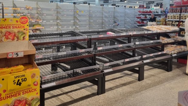
There were reports of panic buying on Monday, as Crisafulli urged supermarkets to ensure supplies remained available.
“My message to the supermarkets would be get in and serve your customers and restock the shelves and do all you can,” he said.
“That’s important. We’re asking Queenslanders to do the right thing, and that means the supermarkets have to as well.”
Bureau meteorologist Sue Oates said the cyclone would produce potentially destructive winds and locally intense rainfall, leading to flooding.
“The damaging winds will commence later in the day on Wednesday, and there is currently a tropical cyclone watch for coastal areas from Sandy Cape to the Queensland border detailing this,” she said on Monday.
“As the system moves closer to towards the coast, and with the understanding that intensification of the system is likely, those destructive winds are possible through Thursday and into Friday.”
Brisbane CityCat and ferry services ended until further notice on Monday night, following advice from Maritime Safety Queensland.
Loading
“I understand this decision will inconvenience people, but the safety of our passengers, crew and vessels must be a top priority,” Lord Mayor Adrian Schrinner said.
“… The combination of high tides, flash flooding, dangerous high winds and intense rainfall creates a serious safety hazard, including debris on the Brisbane River.”
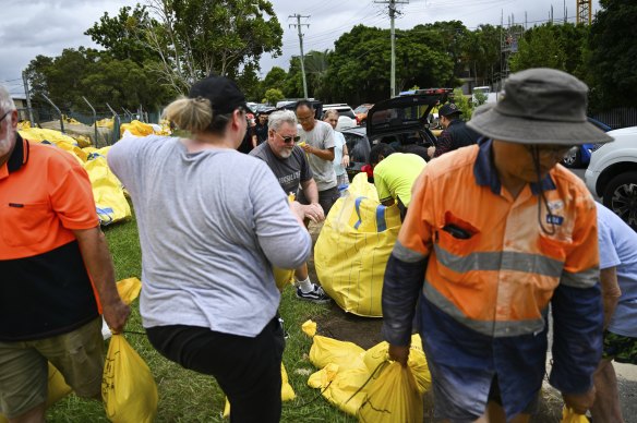
An Energex spokesman said all available crews, vehicles, equipment, and aircraft were being prepared to respond and generators had been deployed at strategic locations to support island communities that were hardest to reach.
Those communities were urged to decide soon whether to evacuate or wait it out.
Loading
Acting Police Commissioner Shane Chelepy said Tuesday might be their last chance to get to seek shelter on the mainland.
“If you are making the decision to leave and go and stay with family and friends, please do so,” he said.
Start the day with a summary of the day’s most important and interesting stories, analysis and insights. Sign up for our Morning Edition newsletter.
Discover more from World Byte News
Subscribe to get the latest posts sent to your email.
